Also known locally as “Georgetown” or “Lower Georgetown”
*
Most of the Village area to the north and east of the Sebasticook River was originally part of St Albans until now familiar town lines were re-established in 1846 and it officially became part of Hartland. The Mill Street Bridge would be built in 1850 connecting Billings Street (future North Street) to Mill Street.
Water Street does not appear to exist until the early 1870s and is shown as an open and unoccupied area on early maps. Given the known history of several major flooding events along the Sebasticook River following the construction of man-made dams in the early 1800s, it makes sense this area of town along the river was not inhabited by some of the early settlers who likely experienced these floods first hand.
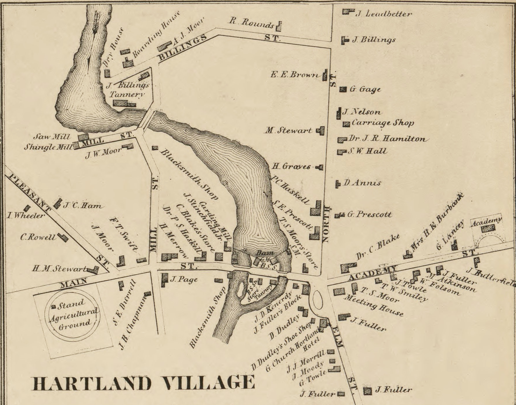
Hartland Village – 1860
*
It’s possible a couple of decades of reprieve from high waters induced future generations to lower their apprehensions and made the area an alluring location for a home given its proximity to the village’s mills, businesses and stores. For whatever reasons, folks eventually decided to build there in the early 1870s and have since dealt courageously with the inevitable and reoccurring forces of nature.
According to notes from former Hartland Town Librarian Mary (Coston) Smith, the area was first referred to as “George’s Town” after 3 men named George became some of the first to build their homes along the eastern bank of the river in the early 1870s; George Wright, George Henderson and George Fairbrother.
It later became known simply as “Georgetown” or “Lower Georgetown” with both nicknames still referred to today by residents and former residents. It is unclear at this point when or why North Street became known as “Upper Georgetown” but it is likely it was a common colloquial reference used by locals which caught on through the generations.
*
The Georges of Georgetown
George Washington Fairbrother (1842-1908) son of Joseph Fairbrother & Sultana Cothran (buried at Warren Hill Cemetery). He served twice in the Civil War with the 9th Maine Infantry, Company D. George and his wife Sarah Frances Brown moved to Pittsfield soon after 1880 before moving to Chelsea, Maine where they are both buried. 2 of their young children who died before they moved are interred at Ireland Cemetery.
George Henderson (1827-1886) came to Maine from Nova Scotia in 1851. He served in the Civil War with the 7th Maine Infantry, Company F. He is interred at Ireland Cemetery with his first wife Sarah who died in 1857 at 18 years old and his second wife Harriet Mackey as well as 2 young daughters and a son.
George E. Wright (1843-1922) son of George P. Wright & Olive Gray. George is interred at Ireland Cemetery with his wife Lucinda Jordan and their 2 infant daughters as well as his parents. George’s younger sister Fanny Wright married Lamont Griffith.
*
About 1872, a small Jail House was built on Water Street to temporarily hold prisoners before being transferred for trial. Around 1883, following a great fire in December of 1878 at the Fuller-Buck General Store at Warren Square in part due to fire equipment being locked up at the Linn Woolen Mill, the town built a dedicated Fire House next to the Jail House where the Hartland Volunteer Fire Department would remain until 1941.
Fire House & Jail House at Water Street Bridge seen during the Great Flood of 1923
*
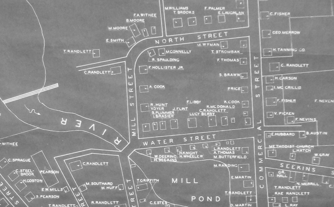
Albeit unnamed, Water Street is seen on the 1883 Map of Hartland Village with 6 houses on the river side spread along the entire length of the street and 4 houses across the street.
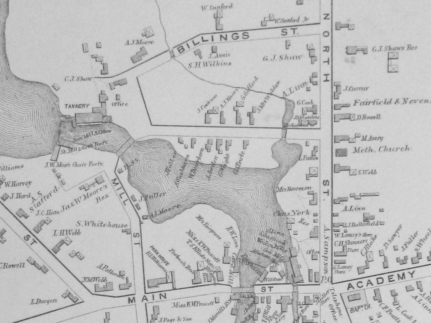
Hartland Village – 1883
*
In the Spring of 1887 a great flood ravaged the area again causing substantial damage as noted in an 1887 Pittsfield Advertiser article, “The section of town known as “Georgetown” is more or less submerged. A house owned by Major (James) Fuller is described at an abrupt angle Sunday, the foundation having gradually been worn away. The Boat House at the Upper Dam and a wing dam connecting to the end of (Greenville) Shaw’s Tannery were carried away.”
*
At the 1897 Town Meeting, the people of Hartland voted to accept an updated list of names for streets in the Village. Most streets retained their original names but a couple were changed or added including, “From the Iron Bridge to said Commercial Street going east as Water Street”.
*
By the turn of the century, houses lined both sides of the street from Commercial Street to Mill Street and the threat of major flooding became a distant memory for most folks living along the always unpredictable river. The sleeping giant awoke when a heavier than usual winter snow pack combined with torrential spring rains cooked up a recipe for disaster for the low lying areas along the Sebasticook River on April 29th, April 30th and May 1st during The Great Flood of 1923. Water Street took the brunt of the flooding waters from the Upper Dam break as well as additional flooding from the river’s smaller secondary outlet from the North Street Bridge.
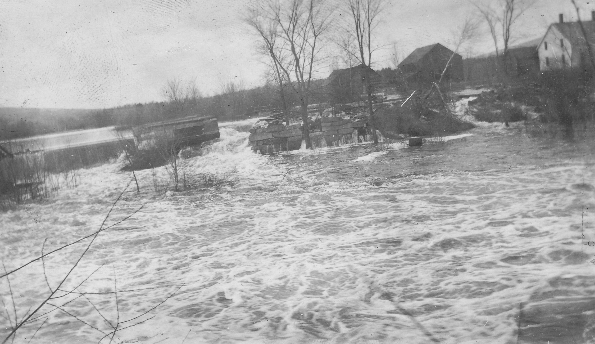
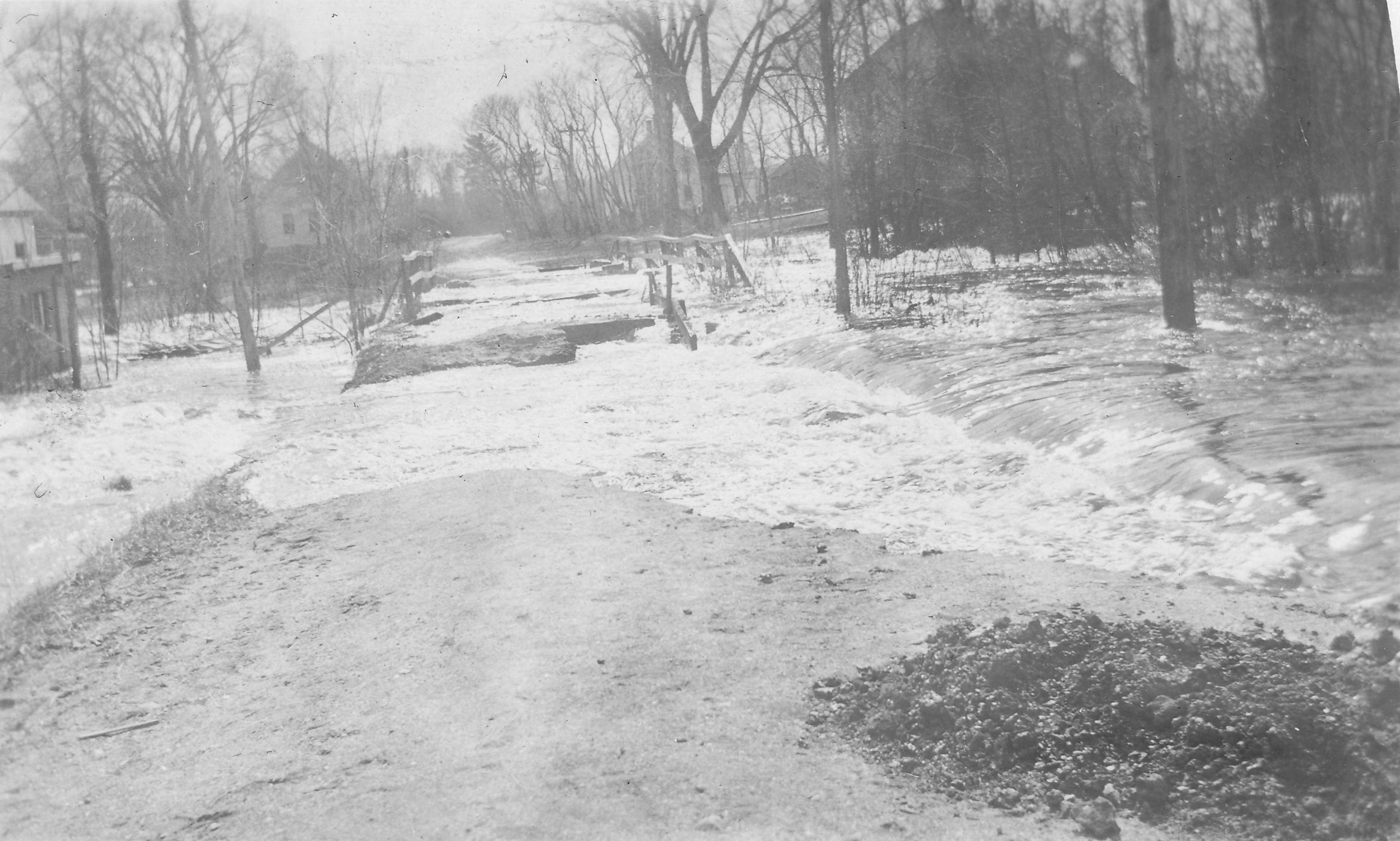
Upper Dam just after it broke sending Flood Waters onto Water Street – 1923
*
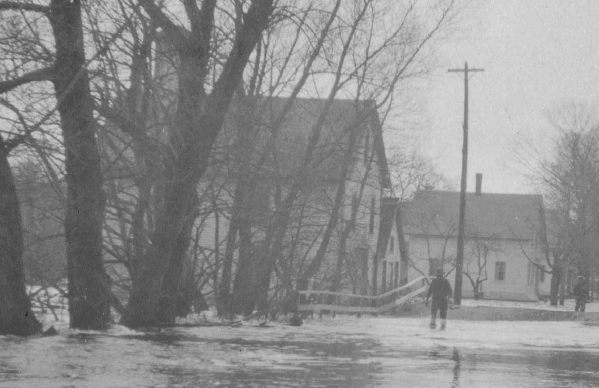
The secondary outlet floods North Street Bridge on its way to Water Street – 1923
*
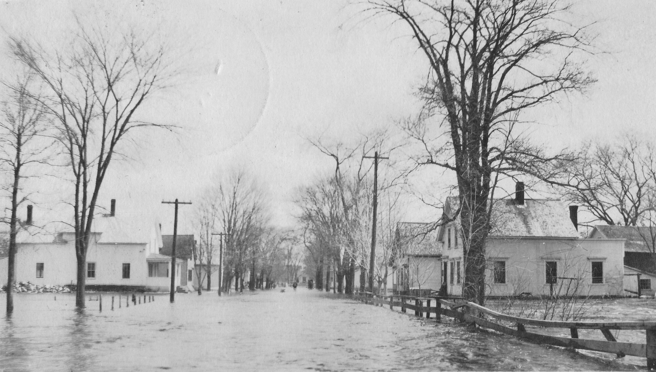
Water Street from Mill Street – 1923
*
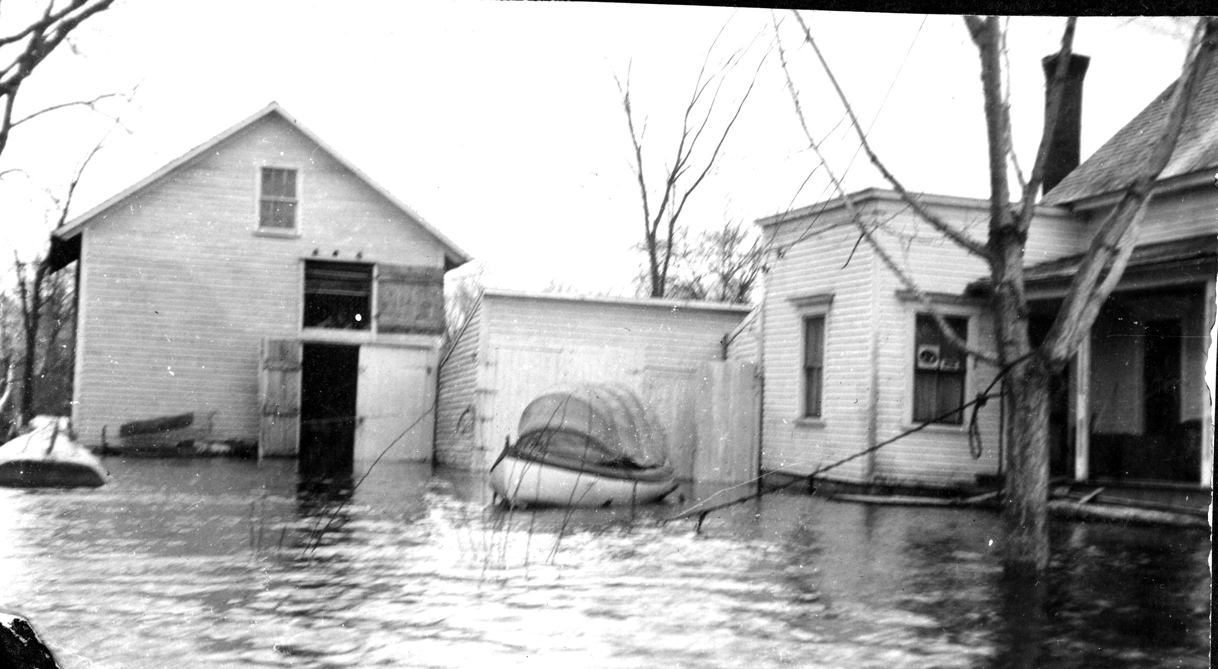
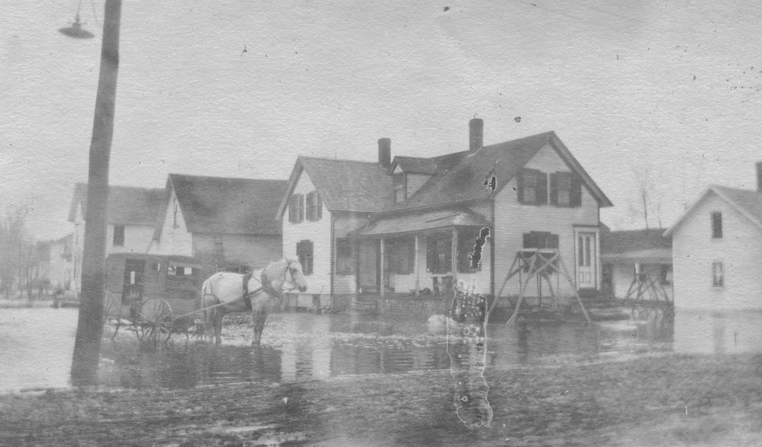
Water Street – Future Mead House – 1923
*
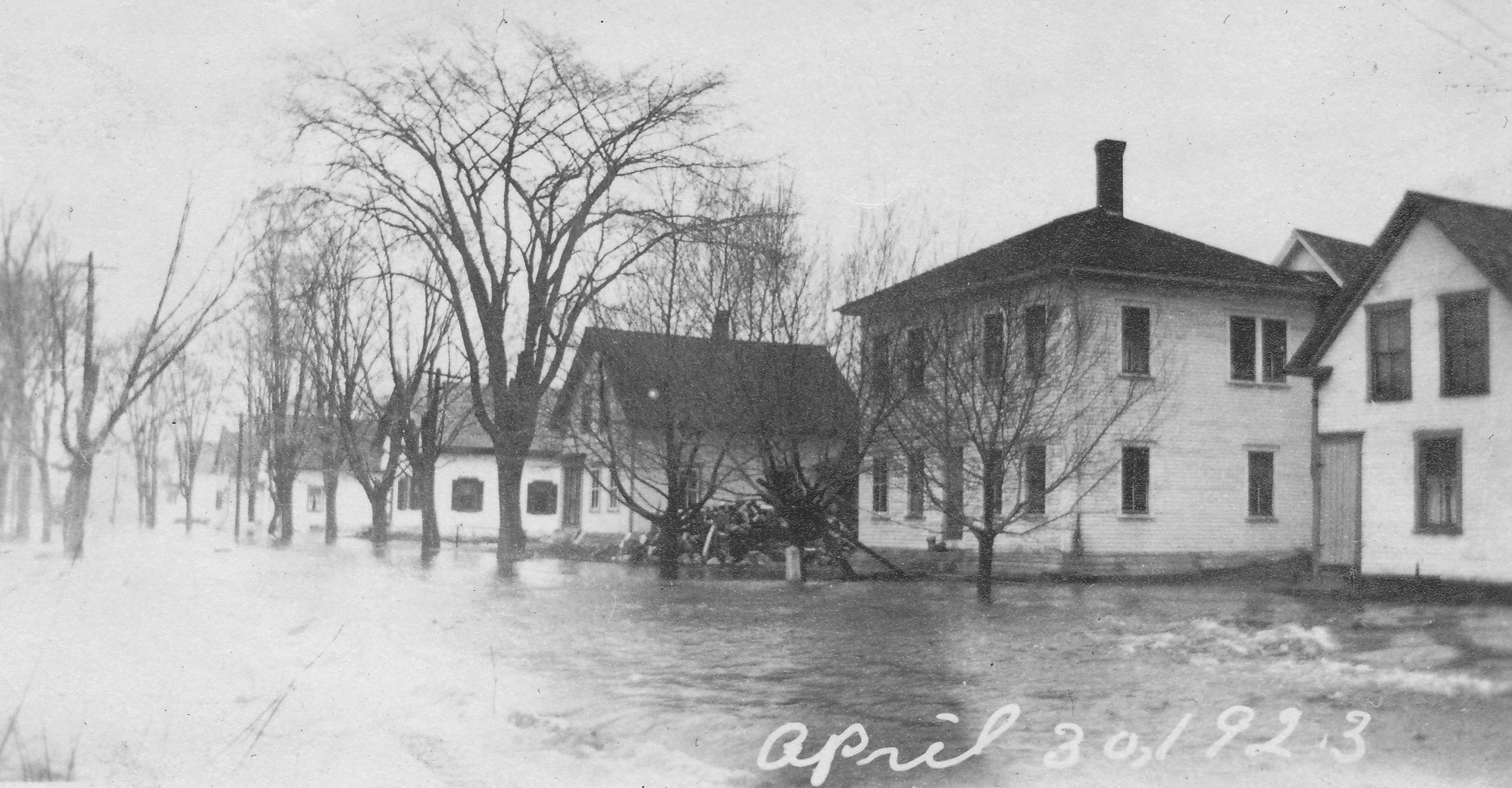
Water Street from Commercial Street – 1923
*
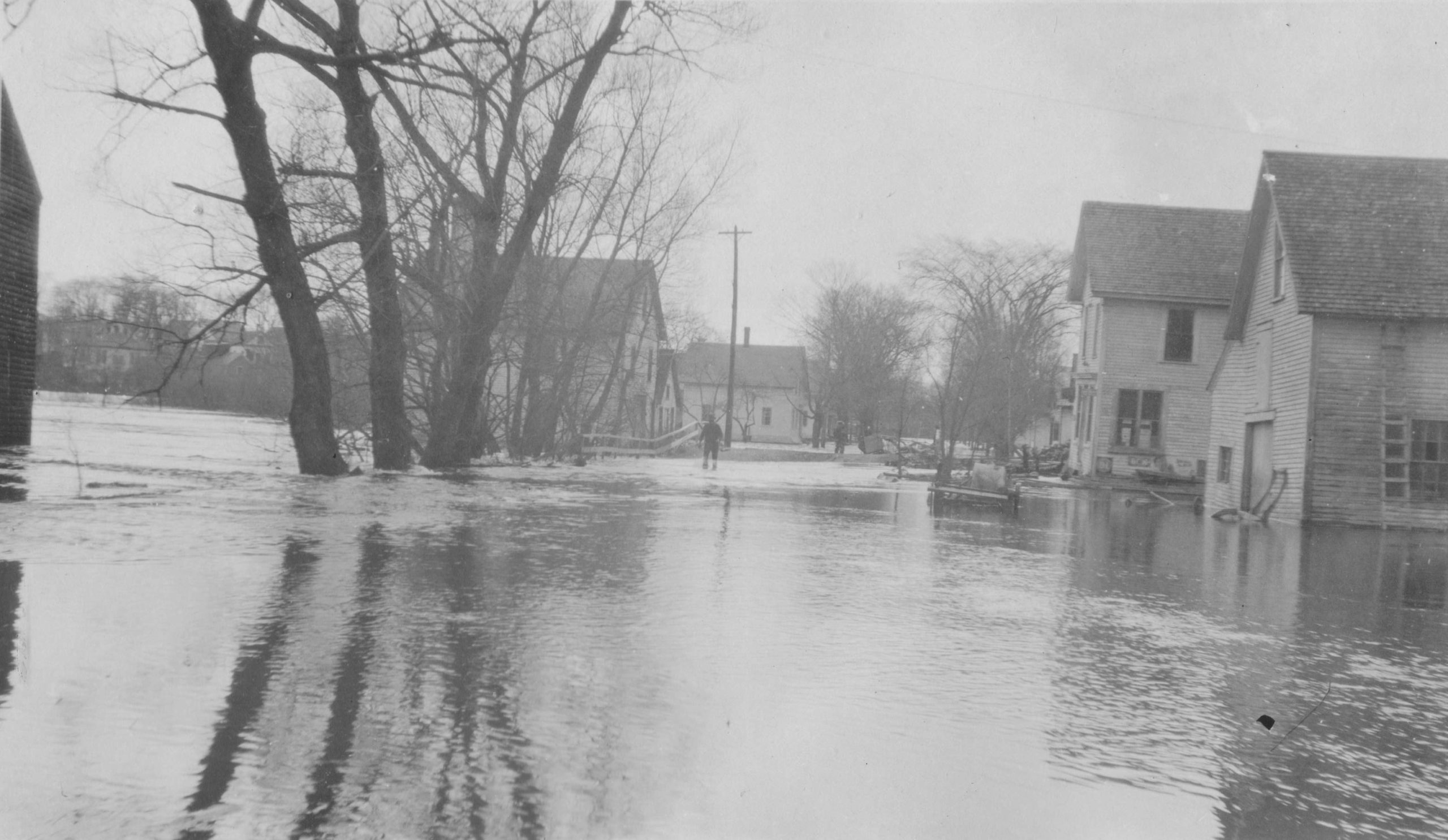
Water Street from Commercial Street – 1923
*
Corner of Water Street & Commercial Street – 1923
*
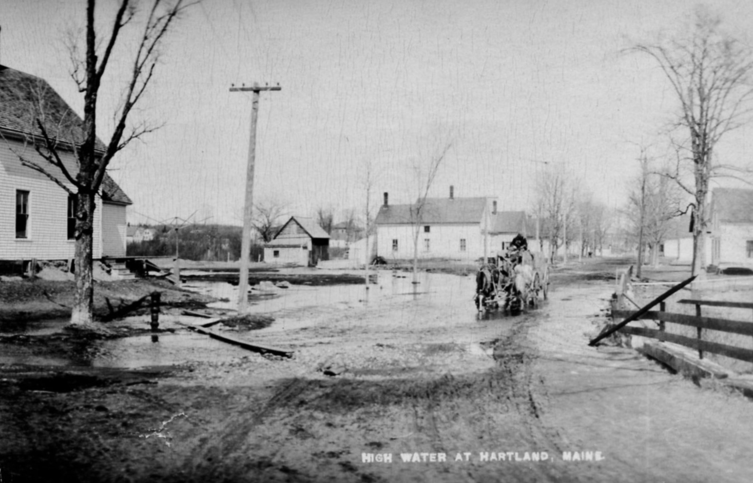
Water Street from Mill Street – Receding Flood Waters – 1923
*
Linwood Boutelle Perkins posed for a photo in front of the Fire House & Jail House across the street from his parents’ house on Water Street.
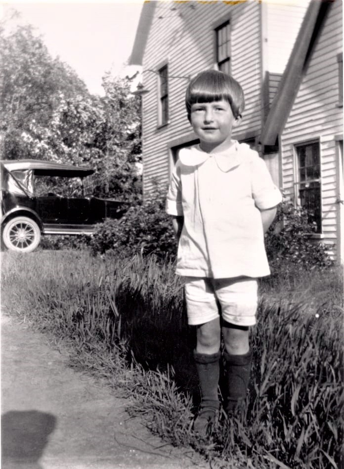
Hartland Volunteer Fire Department Fire House & Jail House – 1926
(Photo courtesy of Dana Perkins)
*
Water Street was lined with houses along both sides of the street in 1943 with the old Jail House & Fire House still standing.
Water Street – 1943
*
Soon after the Fire Department moved to its new Fire Hall location on Hubbard Avenue in 1941, Merrill A. Moore leased the old Fire House from the town for storage purposes for his W. H. Moore & Son Woodworking Company and eventually purchased it.
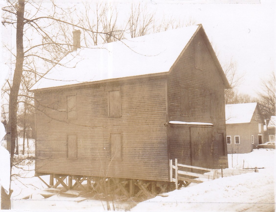
Former Fire Hall as owned by Merrill A. Moore – 1975
*
By 1987, a dike was built on the North Street outlet to prevent any water flow. The Lower Dam was also removed virtually eliminating “Mill Pond” from the upstream overflow of the Sebasticook River. The Main Street Raceway Bridge was removed and new retaining walls were built to surround the tannery; all in an effort to relieve future flooding downstream of the Upper Dam.
Unfortunately, it didn’t take long for the Sebasticook River to test its latest man-made restrictions when it surged well above its banks on the infamous “April Fool’s Day Flood” which swept across much of the region in the Spring of 1987. With the Lower Dam gone, the retaining walls protected, for the most part, the tannery and central Main Street area but once again much of Water Street took the brunt of the flood waters. (Photos courtesy of Joe & Christine Lewis)
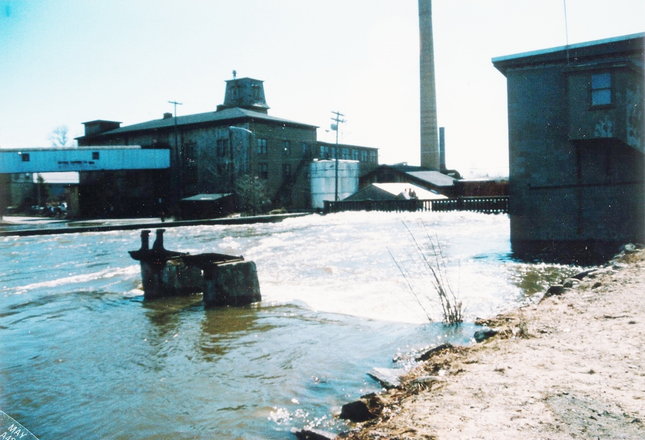
New Retaining Walls strain to hold flood waters – 1987
*
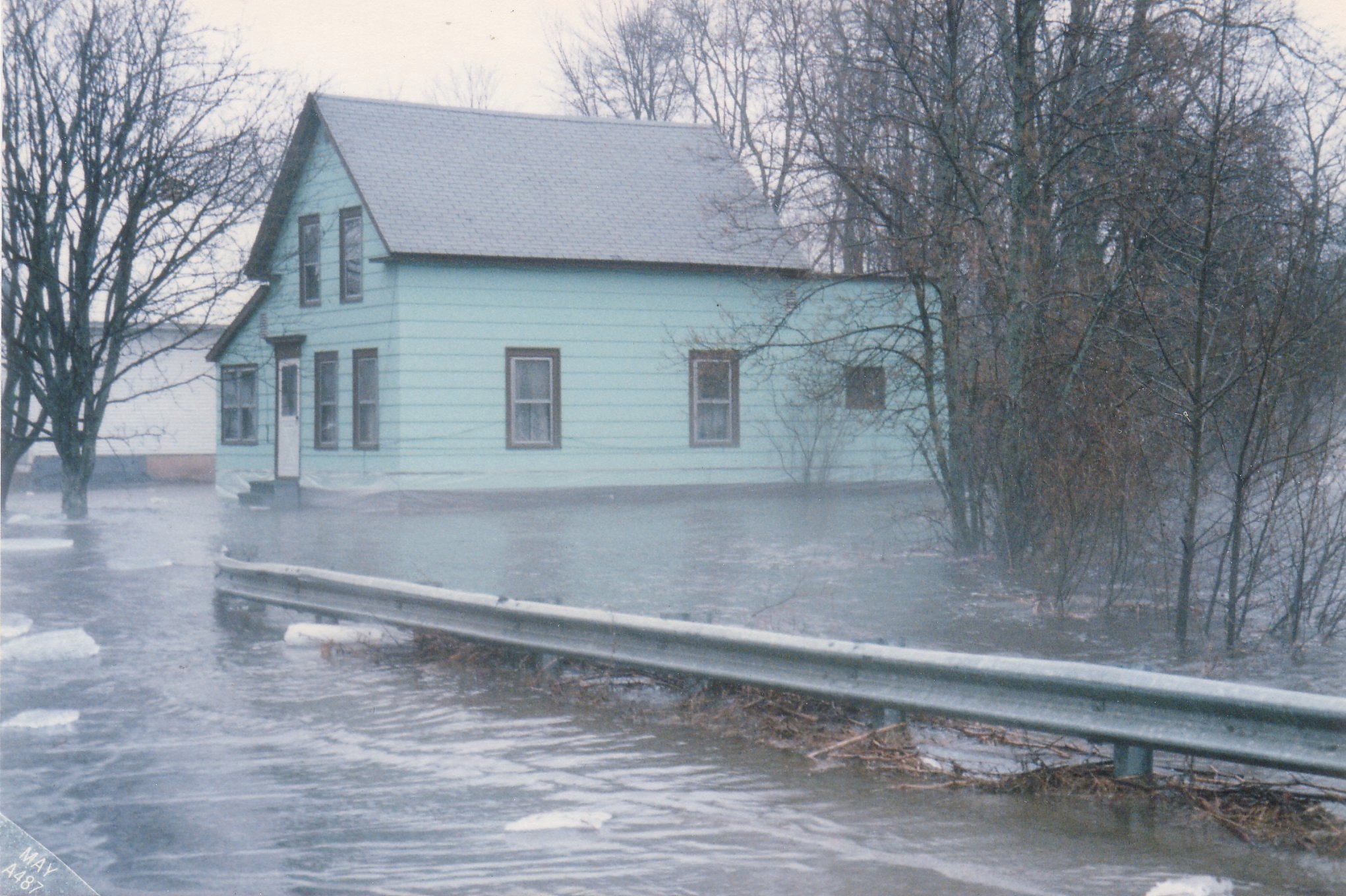
Water Street from Mill Street – George & Merlene Mead House – 1987
*
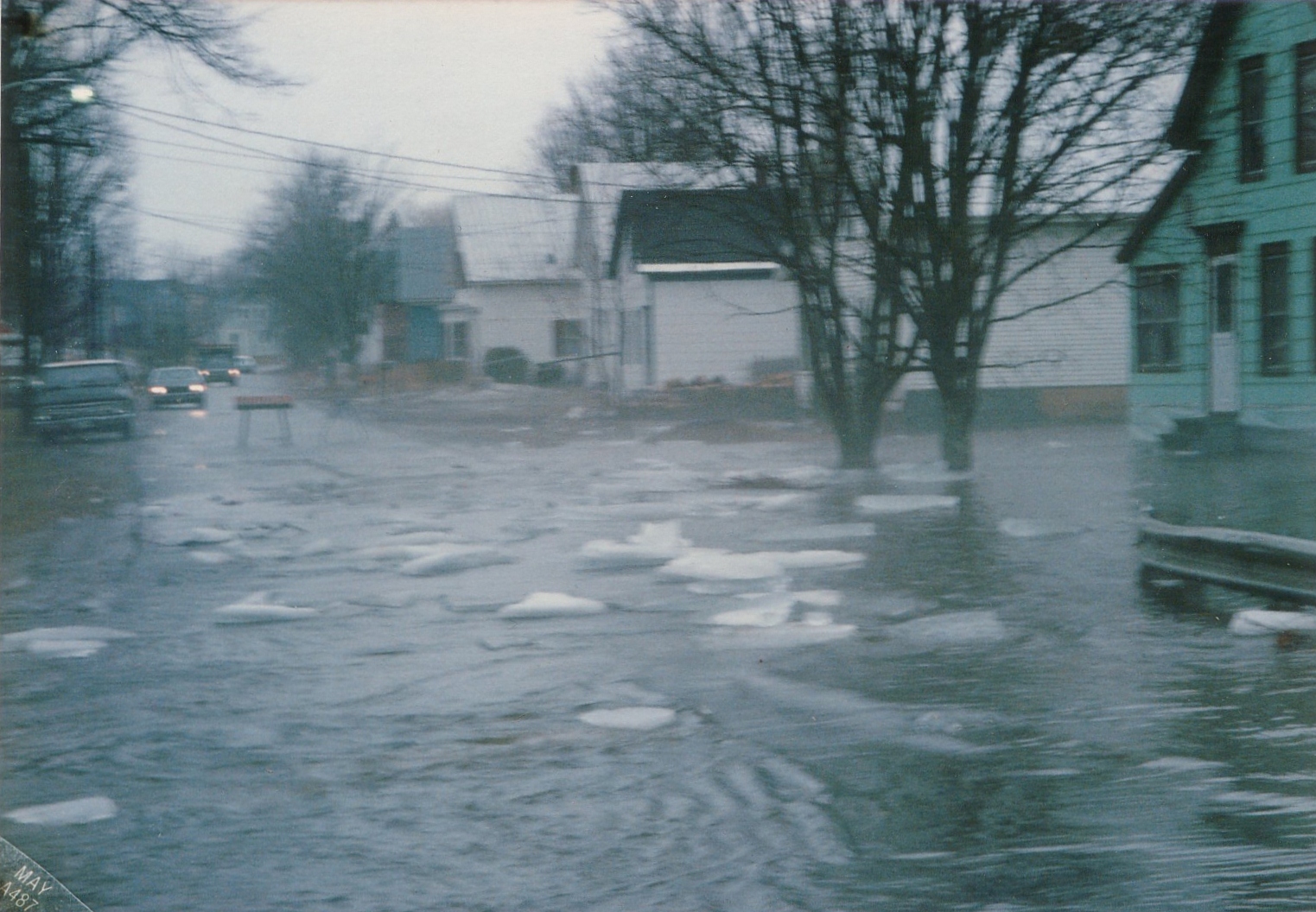
Water Street from Mill Street – Mead House – 1987
*
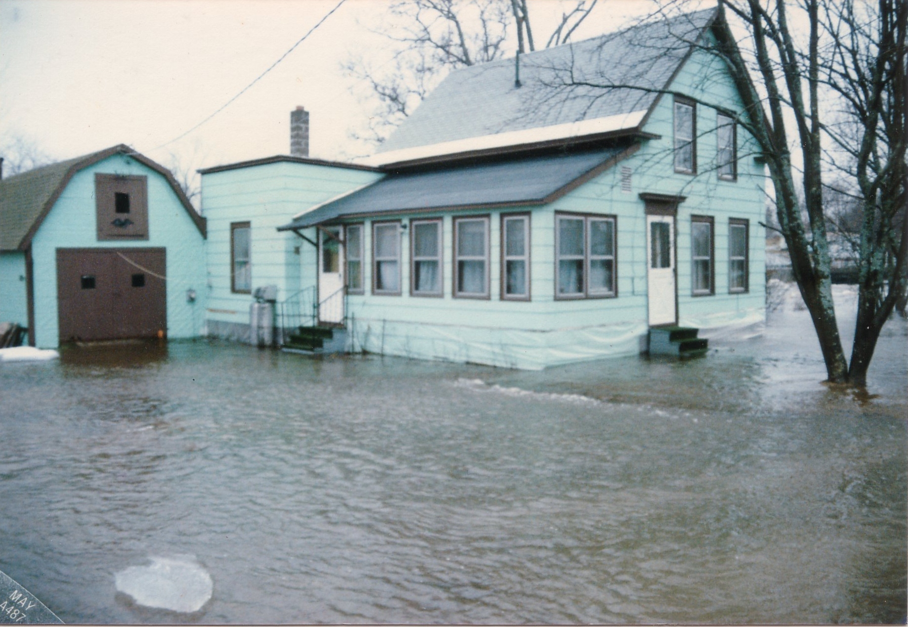
An all to familiar sight reminiscent of 1923 repeated once again at the Mead House – 1987
*
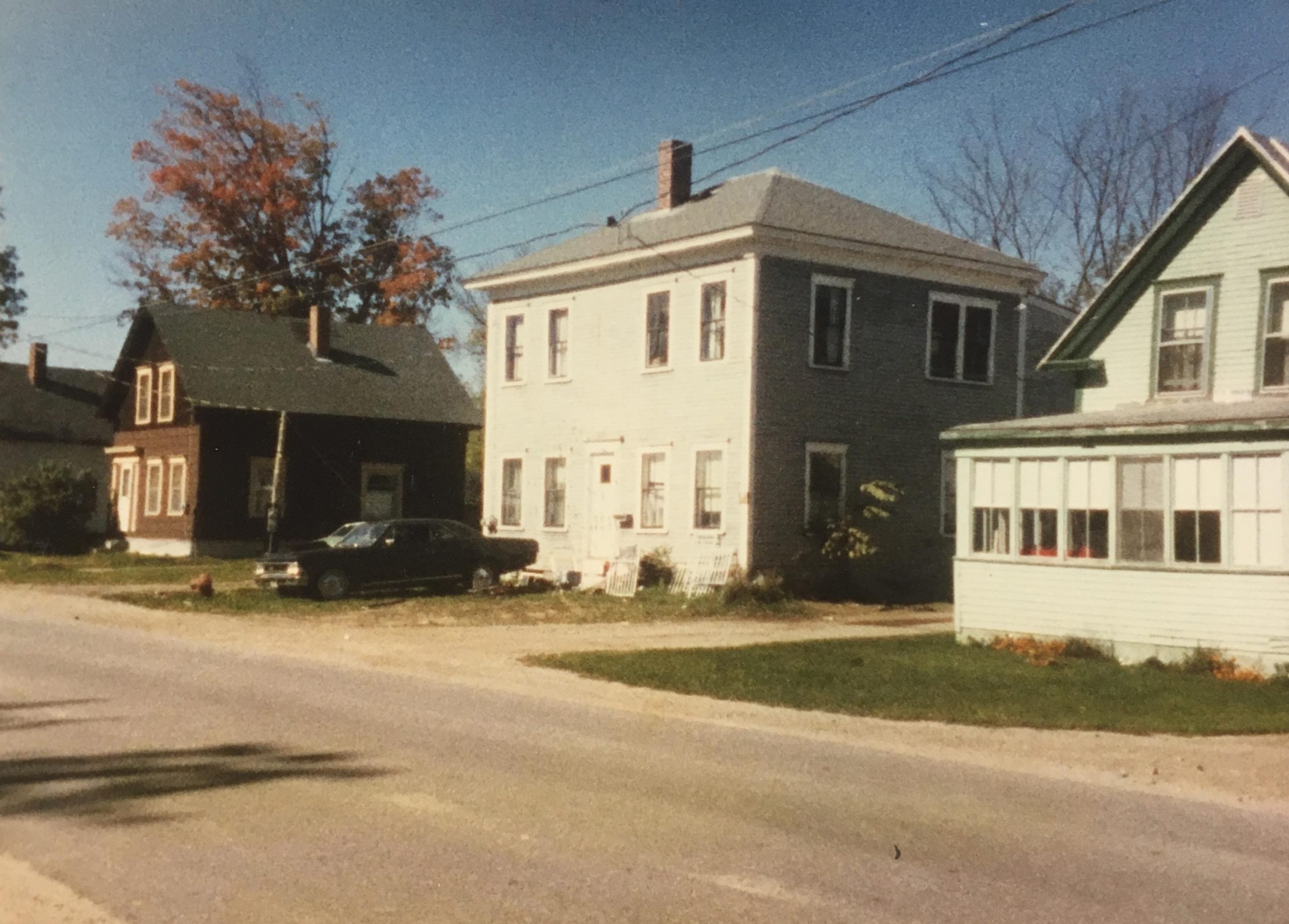
Water Street – 1988